AreaDivider QGIS Plugin Documentation!
sources
save_attributes module
-
class
save_attributes.SaveAttributes(iface)¶ Bases:
object-
add_action(icon_path, text, callback, enabled_flag=True, add_to_menu=True, add_to_toolbar=True, status_tip=None, whats_this=None, parent=None)¶ - Parameters
icon_path (str) – Path to the icon for this action. Can be a resource path (e.g. ‘:/plugins/foo/bar.png’) or a normal file system path.
text (str) – Text that should be shown in menu items for this action.
callback (function) – Function to be called when the action is triggered.
enabled_flag (bool) – A flag indicating if the action should be enabled by default. Defaults to True.
add_to_menu (bool) – Flag indicating whether the action should also be added to the menu. Defaults to True.
add_to_toolbar (bool) – Flag indicating whether the action should also be added to the toolbar. Defaults to True.
status_tip (str) – Optional text to show in a popup when mouse pointer hovers over the action.
parent (QWidget) – Parent widget for the new action. Defaults None.
whats_this – Optional text to show in the status bar when the mouse pointer hovers over the action.
- Returns
The action that was created. Note that the action is also added to self.actions list.
- Return type
QAction
-
apply_graduated_symbology(area_size)¶ Creates Symbology for each value in range of values. Values are # of patients per zip code. Hard codes min value, max value, symbol (color), and label for each range of values. Then QgsSymbolRenderer takes field from attribute table and item from myRangeList and applies them to join_layer. Color values are hex codes, in a graduated fashion from light pink to black depending on intensity
-
createShp(input_line, costs, out_shp, sr)
-
error_msj(uyari)
-
initGui()¶ Create the menu entries and toolbar icons inside the QGIS GUI.
-
input_shp_file()
-
loadLayerList()
-
load_comboBox()¶ Load the fields into combobox when layers are changed
-
run()¶ Run method that performs all the real work
-
runAlgorithm()
-
select_output_file()
-
tr(message)¶ Get the translation for a string using Qt translation API.
We implement this ourselves since we do not inherit QObject.
- Parameters
message (str, QString) – String for translation.
- Returns
Translated version of message.
- Return type
QString
-
unload()¶ Removes the plugin menu item and icon from QGIS GUI.
-
QGIS Plugin Area Divider
Authors:
Atahan Çelebi
Eda Karabaş
Plugin’s User Interface
-Language Support (Eng-Tr)
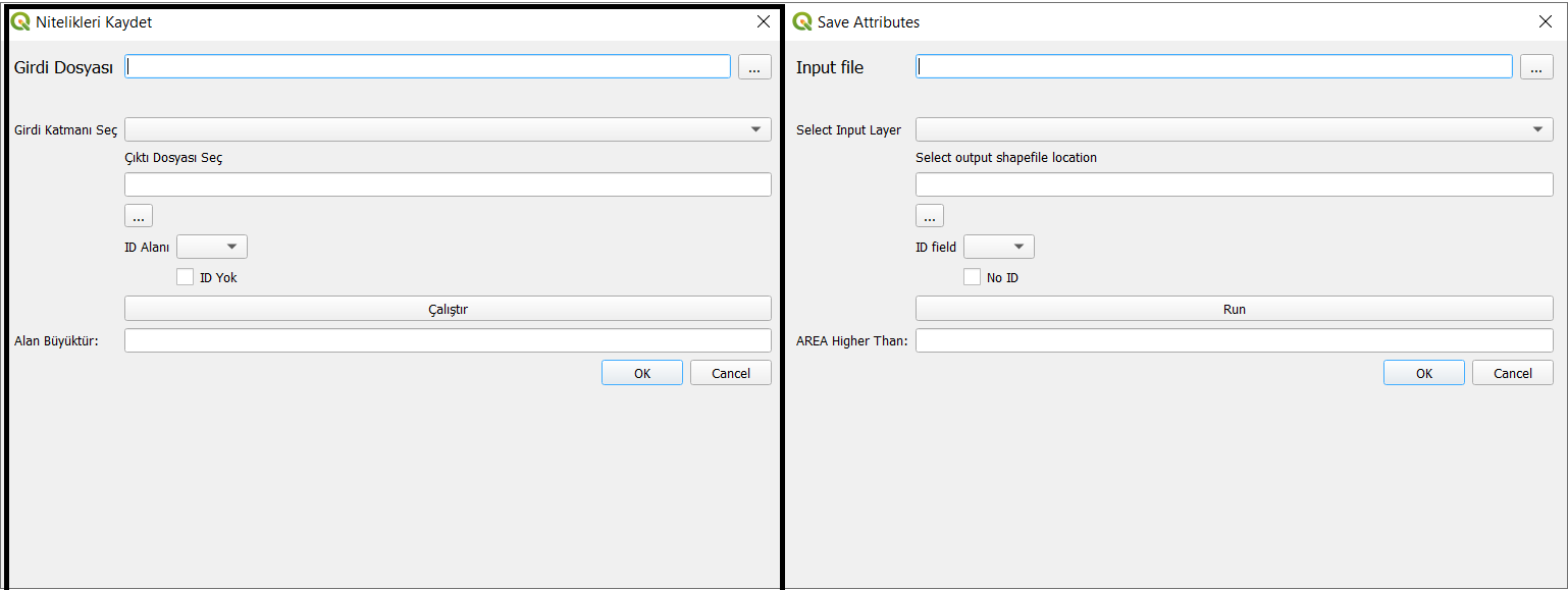
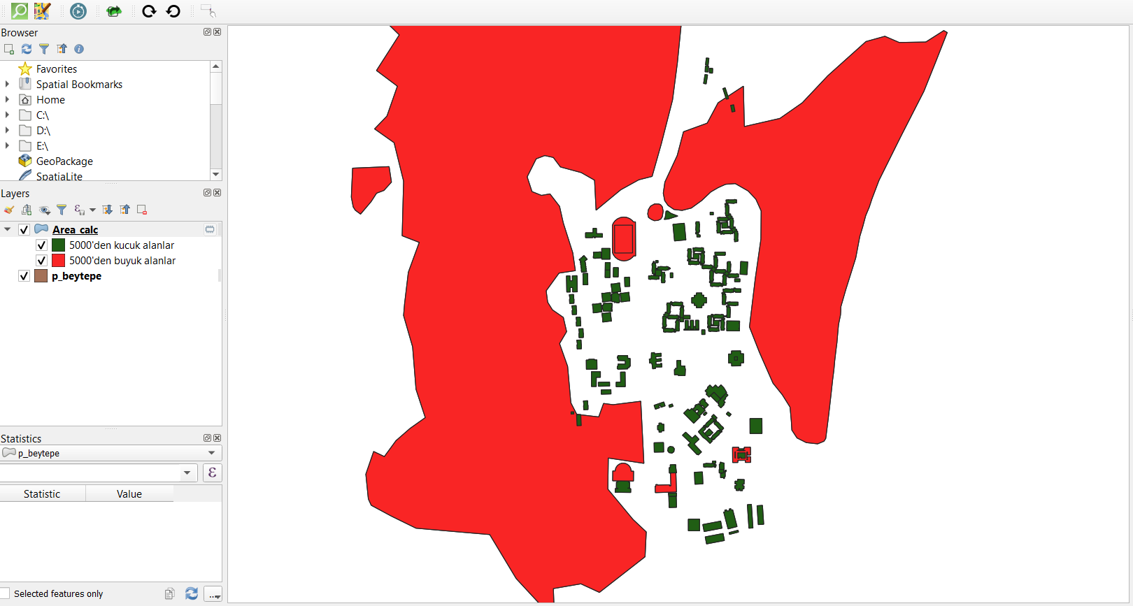
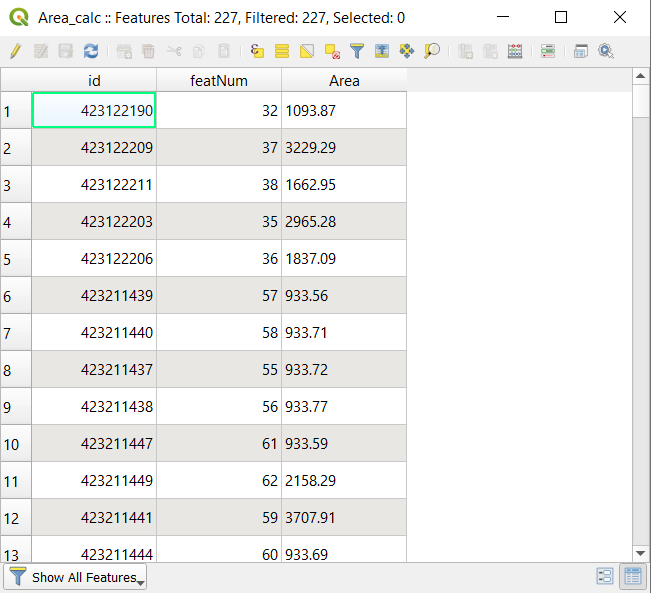
We can see the lower and upper value according to user choice. After the selection of the area unit this part split the higher areas and the lower areas
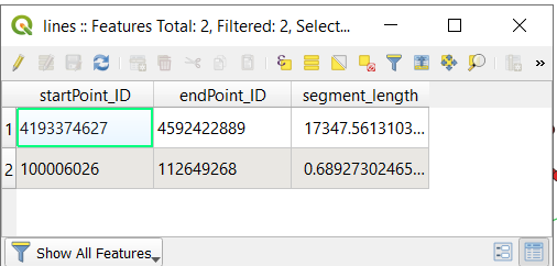
Type of geometry is a point or line
If we select a line shapefile it draws the minimum flight distance between the two points and the their real distance.
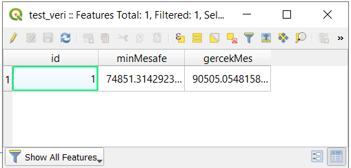
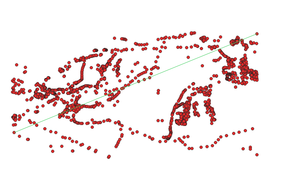
Find the points that have minimum distance and the maximum distance
QGIS Plugin Area Divider
This unit test work for the layer if it has been added or not and check its suitability
Test Layer Transaction -Qgis Project instance/Add map layer whether layer exist -try/except raise error if not exist could not pass unit test
Test Load Layer -Read the layer -If None could not pass unit test
Here is the all code that we implement:
class SaveAttributesTest(unittest.TestCase):
    """Test dialog works."""
    @classmethod
    def setUpClass(cls):
            cls.iface = get_iface()
    def setUp(self):
            """Runs before each test."""
            QgsProject.instance().clear()
            self.dialog = SaveAttributesDialog(None)
            self.attributes=SaveAttributes(get_iface())
            self.attributes.dlg=self.dialog
    def test_Layer(self):
            try:
                    vlayer = QgsVectorLayer("TEST_LINE","line","memory")
                    vlayer = QgsVectorLayer("TEST_LINE","point","memory")
                    vlayer = QgsVectorLayer("TEST_LINE","polygon","memory")

            except:
                    self.assertTrue(True==False)

    def test_Layer_Transaction(self):
            try:
                    vlayer = QgsVectorLayer("TEST_LINE","line","memory")
                    QgsProject.instance().addMapLayer(vlayer)

            except:
                    self.assertTrue(True==False)

    def test_load_layer(self):
            path=os.path.dirname(os.path.realpath(__file__)) + "../../save_attributes/unittests/"
            ds = ogr.Open(path+"c_beytepe.shp",0)
            self.assertTrue(ds==None)

    def tearDown(self):
            """Runs after each test."""
            self.dialog = None


    if __name__ == "__main__":
    suite = unittest.makeSuite(SaveAttributesDialogTest)

    logging.basicConfig(stream=sys.stderr, level=logging.DEBUG)
    runner = unittest.TextTestRunner(verbosity=2)
    runner.run(suite)